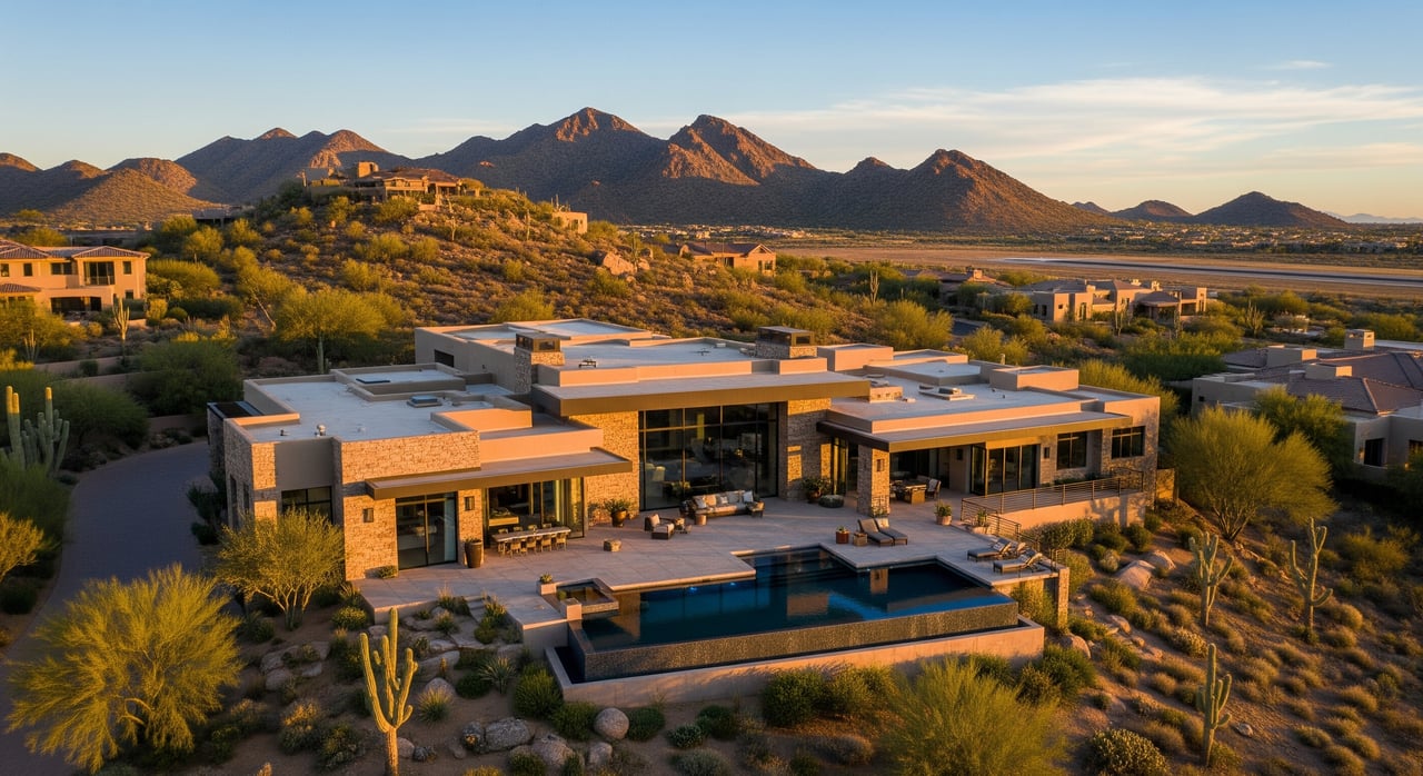
Thinking about using drone photos to showcase your North Scottsdale home near Scottsdale Airport? The right aerials can spotlight lot lines, mountain views, and outdoor living, but the airspace and land-use rules here are not casual. A missed step can delay your launch or put a shoot on hold. This guide gives you the rules in plain English and a simple plan to keep your listing marketing compliant and stress free. Let’s dive in.
Why drone photos near SDL need extra care
Scottsdale Airport (SDL) is a busy, towered airport inside controlled airspace. If your shoot is anywhere near the Airpark or within SDL’s controlled area, your pilot will likely need FAA authorization for the time, place, and altitude of the flight. That is where LAANC comes in, which provides near real-time approvals for many routine operations.
Rules on the ground matter too. The McDowell Sonoran Preserve and certain city parks restrict or prohibit drone use to protect wildlife and visitor safety. Even if you launch from private property, you can still run afoul of preserve or city rules if your flight path crosses restricted land.
The bottom line is simple. Treat every North Scottsdale drone shoot as a regulated operation. Plan the airspace, confirm land-use permissions, and document approvals before you power up.
FAA basics in plain English
Here is what applies to most real-estate shoots near SDL:
- Real-estate listing work is commercial. Your pilot should hold a Part 107 Remote Pilot Certificate and follow Part 107 rules.
- Drones 0.55 lb (250 g) or heavier must be registered with the FAA.
- Standard ceiling is 400 feet above ground level unless authorized otherwise.
- The pilot must keep the drone within visual line of sight and yield to manned aircraft at all times.
- Operations in controlled airspace require FAA authorization. In metro areas like Scottsdale, LAANC is the common, near real-time pathway for many missions.
- Some operations, like flying over people or beyond visual line of sight, require additional waivers. Night operations may also have specific conditions.
- Always check NOTAMs and temporary flight restrictions before launch, especially in a region with multiple airports and events.
Scottsdale specifics to know
Scottsdale Airport and the Airpark
SDL publishes local guidance for unmanned aircraft near the airport and Airpark. The guidance reflects FAA rules, and it may include recommended coordination steps with airport operations, notes on peak traffic times to avoid, and reminders about separation from runways and taxiways. In practice, expect to obtain LAANC authorization when you are inside SDL’s controlled airspace and follow any coordination steps the airport recommends.
McDowell Sonoran Preserve
City-managed preserves often restrict or prohibit drones to protect wildlife and reduce disturbance. Do not assume that launching from a home bordering the Preserve makes an overflight acceptable. Confirm boundaries and rules before you plan a flight path. If permission is possible, expect to secure written approval from the appropriate city or preserve administration first.
City, county, and state public land
City of Scottsdale parks, trails, and other public spaces may require permits for commercial filming, and some areas prohibit drones outright. If your shoot touches Maricopa County or state-managed land, those agencies can have separate policies. Confirm the land manager and permit requirements well before your shoot date.
A compliant workflow for your listing shoot
72–48 hours before
- Confirm the mission is commercial and identify the Remote Pilot in Command. Verify that the pilot holds a current Part 107 certificate.
- Map the takeoff and landing point, planned altitudes, and the exact flight box. Check whether any part of the box sits in controlled airspace or crosses preserve or park land.
- Request LAANC authorization if you are inside controlled airspace. If the pre-approved ceiling is too low for your shot, discuss alternatives or lead time for a different authorization.
- If filming on public property, apply for any required city or park permits. For preserve adjacency, confirm boundaries and any written permissions needed.
- Check NOTAMs and temporary flight restrictions for the specific date and time.
- Follow Scottsdale Airport’s UAS guidance for any recommended coordination with airport operations or tower. Document your communications.
Day of the shoot
- Recheck weather, NOTAMs, and TFRs. Confirm that your LAANC window matches the location, altitude, and time you plan to fly.
- Conduct a safety brief. Assign a visual observer, especially near the Airpark where traffic is dense.
- Verify the pilot’s Part 107 certificate and carry documentation on site. Keep LAANC and any city or preserve permits handy.
- Launch from private property with owner permission, or from a permitted public location. Keep the aircraft within visual line of sight and below the authorized ceiling.
- Do not fly over people who are not directly involved in the operation unless you have the specific authorization that allows it.
After the flight
- Secure equipment and save flight logs. Retain copies of your authorizations and permits.
- Deliver media to your marketing team and store consent or release forms if any individuals were filmed knowingly.
Seller’s quick checklist
Use this to vet a drone vendor and keep the shoot on track:
- Part 107 certificate verified for the pilot in command.
- Drone registration confirmed for aircraft over 0.55 lb.
- Commercial UAS insurance in place and certificate of insurance available on request.
- Clear flight plan with takeoff/landing location, maximum altitude, and a map of the flight box.
- LAANC authorization screenshot for the specific location and time if inside controlled airspace.
- Written permits or permissions if operating on public land or near the Preserve.
- Visual observer assigned and a basic safety plan outlined.
- Plan to respect privacy, avoid filming through windows, and minimize noise near neighbors.
- Contingency plan for wildlife encounters and a go/no-go call if conditions change.
Practical tips for neighbors and privacy
- Notify adjacent neighbors of the planned date and expected flight window. A short, polite note reduces surprises.
- Focus the camera on the subject property. Avoid lingering on neighboring yards and interiors.
- Schedule flights during daylight with calmer winds for better footage and fewer passersby.
- Keep takeoff and landing areas clear and away from pedestrian activity.
When to hire a pro
Near SDL, a professional Part 107 pilot with local airspace experience is your safest path. Ask for recent examples of LAANC authorizations in North Scottsdale, proof of insurance, and a written plan that shows how they will avoid preserve land and comply with any park rules. If your property is very close to the runways or in a sensitive area, this preparation becomes even more important.
Questions to ask before you book:
- Have you flown near the Scottsdale Airpark before, and what altitudes were authorized?
- Do you provide LAANC documentation and carry your Part 107 certificate on site?
- How do you confirm preserve boundaries and city permit needs?
- What is your safety protocol for visual observers, batteries, and emergency procedures?
How we help your marketing stay compliant
You deserve elevated visuals without last-minute surprises. As part of our full-service listing preparation, we help you plan an aerial strategy that fits the rules, timeline, and story of your home. We coordinate with experienced, Part 107–certified vendors, confirm the right authorizations are in place, and integrate drone assets into a cohesive launch plan alongside staging, targeted advertising, and Compass Concierge upgrades where applicable.
If you are considering drone media for a home near SDL or the McDowell Sonoran Preserve, let’s build a compliant plan that highlights your property and protects your timeline. Connect with AB Residential to start with a thoughtful home valuation and marketing strategy.
FAQs
Do I need permission from Scottsdale Airport to fly a drone near SDL for my listing?
- If your location sits in SDL’s controlled airspace, the pilot must obtain FAA authorization, commonly through LAANC, and follow the airport’s published UAS guidance for any recommended coordination.
Can you fly over the McDowell Sonoran Preserve during a nearby listing shoot?
- Preserve rules frequently restrict or prohibit drones; do not launch from or fly over preserve land without explicit written permission from the appropriate city or preserve authority.
What is LAANC and when do you need it near Scottsdale Airport?
- LAANC is a system that provides near real-time FAA airspace authorizations in controlled airspace; you use it when the planned flight area around SDL requires authorization and your mission fits the program’s parameters.
Can a homeowner authorize a drone flight from their backyard in North Scottsdale?
- You need the property owner’s permission to launch, but private permission does not replace FAA airspace rules or city and preserve restrictions; both sets of rules still apply.
What happens if a pilot ignores the rules near SDL?
- FAA civil penalties, enforcement, or certificate actions are possible, and local fines or removal from preserves or parks can occur; noncompliance can also delay your listing timeline.
Who should I contact for final authorization questions in North Scottsdale?
- Check FAA resources for LAANC and NOTAMs, follow Scottsdale Airport’s UAS guidance for any coordination steps, and contact the City of Scottsdale or preserve administration for permits or permissions related to public land.